5/5 ARC 3 months ago on Google New
It
is
not
supposed
to
be
possible
to
walk
the
full
length
of
the
river
Liffey
-
to
do
that
you
would
be
"off
road"
through
bog
and
wetlands
for
a
lot
of
the
journey
-
the
challenge
is
not
for
the
faint
hearted.
However,
proud
to
report
that
my
son
Marc
finished
his
walk
from
the
Liffey
Head
Bog
to
Poolbeg
Lighthouse
today,
the
27th
December
2023.
Gwan
Marc.
The
Liffey
rises
in
the
Liffey
Head
Bog
between
the
mountains
of
Kippure
742
metres
(2,434
ft)
and
Tonduff
642
metres
(2,106
ft)
in
the
northern
section
of
the
Wicklow
Mountains,
forming
from
many
streamlets
near
the
Sally
Gap.
The
underlying
geology
of
this
upland
area
has
an
impact
on
the
river.
The
underlying
granite
bedrock
was
formed
during
the
Devonian
Period
between
415
and
360
million
years
ago.
There
there
are
dams
at
three
locations
along
the
river
-
hydroelectric
power
stations
(Poulaphouca,
Golden
Falls
and
Leixlip).
There
is
one
waterfall
called
Pol-a-Phuca
or
the
Daemon's
Hole,
is
about
one
mile
from
the
village
of
Ballymore
Eustace
-
in
rainy
seasons,
when
the
river
is
much
swollen,
the
fall
is
calculated
at
150
feet
in
height.
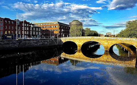
Leixlip,
Lucan,
Celbridge,
Athgarvan
and
Ballymore
Eustace
are
some
towns
in
Ireland
passed
by
River
Liffley
because
it
ends
in
Dublin.
The
Liffley
has
a
number
of
tributaries,
which
include
River
Camac,
River
Poddle,
River
Dodder,
and
King’s
River.
Drinking
water
accounts
for
circa
60%
of
the
water
flow
on
the
river
(no
Guinness
was
not
created
by
usingthe
water
from
the
Liffey
-
although
the
brewery
is
located
on
the
river).
The
river
flows
for
132
km
through
Wicklow,
Kildare
and
Dublin
before
entering
the
Irish
Sea
in
Dublin
Bay
-
best
way
to
see
it
out
to
sea
is
at
the
Poolbeg
Lighthouse.
Who
named
this
ancient
river?
The
Liffey,
Abhainn
Life,
Avenlif
and
Joyce's
Anna
Livia
Plurabelle
-
all
these
names
most
likely
derive
from
Magh
Life,
the
rich
plain
or
Magh
of
County
Kildare
through
which
the
Liffey
loops
and
curls
on
her
way
to
the
sea.
1 person found this review helpful 👍