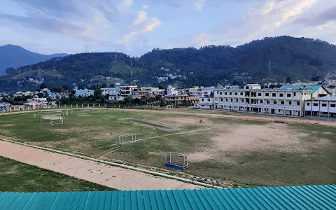
5/5 Ravi S. 3 years ago on Google
Good
platform
for
Local
boys
to
show
your
talent
and
go
to
level
thanks
for
sports
stadium
Pithoragarh
Pithoragarh is
the
easternmost
district
in
the
state
of
Uttarakhand.
It
is
located
in
the Himalayas and
has
an
area
of
7,110 km2 (2,750 sq mi)
and
a
population
of
483,439
(as
of
2011).
The
city
of Pithoragarh,
located
in Saur
Valley,
is
its
headquarters.
The
district
is
within
the Kumaon
division of
Uttarakhand
state.
The Tibet plateau
is
situated
to
the
north
and Nepal is
to
the
east.
The Kali
River is
formed
by
the
joining
of
two
headwaters
near Gunji and
flows
south,
forming
the
eastern
border
with
Nepal.[1] The
Hindu
pilgrimage
route
for Mount
Kailash-Lake
Manasarovar passes
through
this
district
via Lipulekh
Pass in
the
greater
Himalayas.
The
district
is
administratively
divided
into
six tehsils: Munsyari; Dharchula; Didihat; Berinag; Gangolihat;
and
Pithoragarh. Naini
Saini
Airport is
the
nearest
civil
airport,
but
it
does
not
have
regular
scheduled
commercial
passenger
service.
The
mineral
deposits
present
in
the
district
are magnesium ore,
copper
ore, limestone and slate.
There
are
11 tehsil.
Pithoragarh is
a
Himalayan
town
with
a
Municipal
Board
in Pithoragarh
district in
the
Indian state of Uttarakhand.
It
is
the
largest
organised
semi-urbanised
to
urbanised
town
in
Kumaon.The
town
has
all
the
facilities
including
an
airport.
It
has
become
an
education
hub
of
the
hilly
region
as
the
town
has
Laxman
Singh
Mahar
Govt.P.G.College,
Seemant
Institute
of
Technology,
and
a
nursing
college
catering
to
the
needs
of
all
the
nearby
towns
as
well.
❤❤❤❤❤
2 people found this review helpful 👍