4/5 J M. 2 years ago on Google • 8 reviews
Well…if
you
like
elevation
gain,
but
you
think
switchbacks
are
for
cheaters…you…will
love…this
hike.
tl;dr
no
water,
steep
trails,
use
trekking
poles.
The
out
takes
as
long
as
the
in,
plan
accordingly.
Don’t
let
the
gentle,
sloped
driveway
approach
lure
you
into
a
false
sense
of
security.
This
trail
will
compete
with
the
first
20
miles
of
the
PCT.
I
did
this
with
my
new
pack
as
a
shakedown
and
it
went
well,
but
there
are
no
switchbacks
after
the
first
mile.
Everything
is
either
going
up
a
hillside
or
down
it.
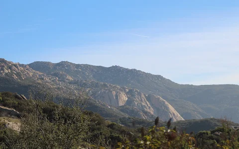
Dry
conditions,
loose
sand,
and
granite
boulders
make
for
a
nice
winter
climb
and
lots
of
slip
and
fall
potential.
Bring
trekking
poles.
Keep
in
mind
that
the
rolling
steep
hills
mean
nearly
a
600
feet
of
climbing
on
the
way
out,
when
you’re
already
fatigued,
and
the
steep,
sand
and
boulder
ascents
are
also
steep
slippery
descents,
which
need
to
be
taken
slowly
and
carefully.
It
takes
as
long
to
get
out
as
in.
There
is
no
real
water
on
trail,
so
anticipate
you
water
needs.
I
burned
2L
and
finished
the
last
mile
dry,
in
December.
The
view
of
practically
all
of
Southern
California
is
worth
it,
but
this
is
a
7
hour
expedition,
so
know
your
schedule
and
your
limits.
Know
when
to
turn
back.
8 people found this review helpful 👍