5/5 Stephen L. 7 months ago on Google
These
two
places
are
very
popular
with
local
people.
The
walk
is
becoming
a
victim
of
its
own
popularity
in
that
the
paths
in
places
are,
at
this
time
of
year,
extremely
muddy
and
slippery.
There
are
four
main
access
points.
Via
a
PRoW
at
the
bottom
of
Barr
Common
Hill
near
the
junction
with
Bosty
Lane.
Two
off
the
B4151
Sutton
Road.
The
eastern
access
forms
an
access
point
for
the
Beacon
Way,
further
west
near
the
old
Three
Crowns
pub,
at
the
top
of
the
hill
of
the
same
name.
The
4th
is
to
the
north
off
Aldridge
Airport
and
Longwood
Lane,
again
an
access
point
of
The
Beacon
Way.
It
is
a
lovely
area
to
walk
through
at
every
season,
particularly
in
late
spring,
when
the
woodland
floor
is
covered
with
either
Ramsons(Wild
Garlic)
or
Bluebells.
See
pics.
The
extent
of
each
plant
is
controlled
by
the
geology
of
the
area.
It
can
be
very
muddy
underfoot
in
winter
&
spring.
A
review
says
there
is
no
parking
or
you
park
on
the
main
road.
There
is
parking
to
found
in
the
service
road
to
Sutton
Road
Garden
Centre.
From
the
northern
access,
a
car
park
exists
adj
to
Aldridge
airport/Longwood
Lane
(closed
currently)
and
the
Fountain
Café
takeaway
&
adjacent
to
Killock.
The
geological
fault
mentioned
can
be
estimated
by
the
change
in
vegetation
Beech
to
Oak
or
vice
versa.
The
beech
woodland
and
Ramsons
are
related
to
the
Silurian
Barr
Limestone,
where
exposed,
consists
of
grey-green
hard
nodular
crystalline
limestone
bands,
which
have
few
fossils
interbedded
with
finely
laminated
calcareous
shale,
which
has
a
rich
micro-fossil,
and
occasional
macro-fossil
content.
If
you're
very
lucky,
you
may
find
the
head
shield
of
Bumastus
barriensis
trilobite.
The
limestone
bands
were
quarried
in
an
open-cast
linear
quarry
in
the
18th&19th
centuries,
and
ceased
in
1820s.
The
limestone
was
in
great
demand
for
the
construction
of
locks,
docks
and
bridges
as
it
had
"extraordinary
adhesive,
strength
and
durable
qualities."
However
the
Hayhead
Quarry
was
closed
and
abandoned
despite
the
owner
having
the
canal
arm
to
the
mines
constructed.
The
abandoned
opencast
trench
forms
the
linear,
periodically
flooded
depression
we
see
today
extending
from
the
Dingle,
Sutton
Road
to
the
beginnings
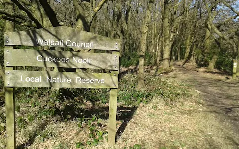
of
Cuckoo's
Nook
in
a
gentle
curved
line.
The
oak
woodland
and
Bluebells
is
related
to
the
Carboniferous
Sands
and
shales
on
the
east
side
of
the
fault.
There
used
to
be
info.boards
explaining
this,
but
sadly
they
have
been
vandalised.
There
is
a
proposed
housing
development
adjacent
at
the
site
of
the
old
Three
Crowns
Pub.
The
development
is
said
to
"impinge"
on
the
access
or
footpath
from
the
top
of
Three
Crowns
Hill,
off
the
Sutton
Road.
Look
at
the
planning
proposal
with
Walsall
Council
for
more
details.
The
redevelopment
of
the
site
has
been
paused
as
the
developer
has
gone
out
of
business.
Dog
owners
should
note
that
there
are
no
bins
to
dispose
of
your
dog's
poo,
so
it
will
have
to
be
carried
until
a
suitable
bin
can
be
found.
6 people found this review helpful 👍