4/5 Sita Dewi R. 5 years ago on Google
(Translated
by
Google)
For
those
who
bring
a
motorbike,
you
can
leave
it
at
the
shop,
mbok
yem
(in
front
of
UNIK)
From
the
unique
direction,
turn
left
towards
Lebak
(the
road
that
goes
up).
The
road
goes
up
for
a
while
on
the
right
of
the
road
there
is
a
footpath
that
has
PDAM
From
post
1
take
the
left
road
to
get
to
Watu
Bengkah,
just
go
straight.
Through
the
river
3
times
but
the
river
has
no
running
water
T.T
Later
there
will
be
a
fork,
straight
and
right
that
goes
up.
We
take
it
straight.
Then
there
is
another
branching
right
and
left,
we
take
the
right
path
(there
is
an
arrow
on
the
rock2)
The
path
is
mostly
moving
rocks
and
dusty
sand.
It's
a
shame
that
there
is
a
damaged
climbing
route
(in
my
opinion)
because
it
is
passed
by
trail2
:(
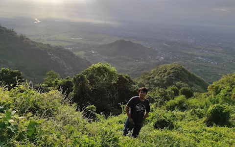
From
the
parking
lot
to
the
top
of
Watu
Bengkah
it
takes
1.5
hours
(a
very
relaxing
walk)
And
DON'T
FORGET
TO
BRING
A
SUPPLY
OF
WATER!!!
very
hot,
dry
etc
(Original)
Untuk
yang
bawa
sepeda
motor
bisa
di
titipkan
ke
warung
nya
mbok
yem
(depan
UNIK)
Dari
arah
unik
belok
kiri
ke
arah
lebak
(jalanan
yg
naik).
Jalan
naik
sebentar
kanan
jalan
ada
jalanan
setapak
yg
ada
PDAM
Dari
pos
1
ambil
jalan
kiri
untuk
ke
watu
bengkah,
lurus
aja.
Lewat
sungai
3x
tapi
sungainya
tidak
ada
air
mengalir
T.T
Nanti
ada
percabangan,
lurus
dan
kanan
yg
naik.
Kita
ambil
lurus.
Lalu
ada
percabangan
lagi
kanan
dan
kiri,
kita
ambil
jalur
kanan
(ada
tanda
panah
di
batu2)
Jalurnya
mayoritas
batu2an
gerak
dan
pasir
berdebu.
Sangat
di
sayangkan
ada
jalur
nanjak
yg
rusak
(menurut
aku)
karena
dilewati
oleh
trail2
:(
Dari
parkiran
sampai
puncak
watu
bengkah
membutuhkan
waktu
1,5
jam
(jalan
santai
banget)
Dan
JANGAN
LUPA
BAWA
PERSEDIAAN
AIR!!!
panas
banget,
kering
dll
4 people found this review helpful 👍