1
Rurtal with the rock formations of Uhusley
Hiking area
👍👍 Sehr schöner Eifelsteig Wanderweg Nichts für Turnschuhgänger.Die Wege sind zum Teil extrem steil und sehr oft wirklich steinig und stellenweise wirklich uneben.
Also festes Schuhwerk ist wirklich nötig bzw. entfehlenswert.
Ansonsten gibt es viele wunderschöne Aussichtpunkte.
Urige Landschaften und...
4.70 (467 reviews)
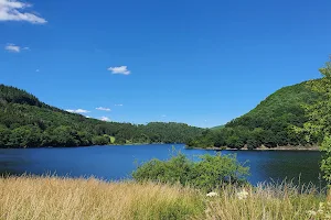
2
Obersee Uferweg
Hiking area
👍👍 Ein schöner Weg zwischen Einruhr und Rurberg. Meist flach, aber auch mit starken Steigungen, steinig, fast durchweg mit Blick aufs Wasser, 4,5 km lang. Es gibt Bänke und Picknickplätze, auch eine Liege mit bestem Blick auf die schöne Landschaft und den Obersee erwarten einen.
Zurück kann man auch d...
4.60 (45 reviews)
3
Heilsteinbrunnen Einruhr
Tourist attraction
👍👍 Schöner Brunnen in einem ruhigen Innenhof. Mit Sitzgelegenheiten und Wasserpark nebenan. (August 2023)
4.70 (45 reviews)