4/5 சூழல் அறிவோம் �. 3 years ago on Google
(Translated
by
Google)
The
Namakkal
area
is
referred
to
as
'Thiruvaraikkal'
in
the
inscriptions
on
the
north-western
and
southern
walls
of
the
Paladaina
temple
located
on
the
hill.
Namakkal
is
also
known
as
the
'City
of
Chickens'
and
the
'Egg
City'
as
the
eggs
sent
to
most
parts
of
the
country
are
produced
in
Namakkal.

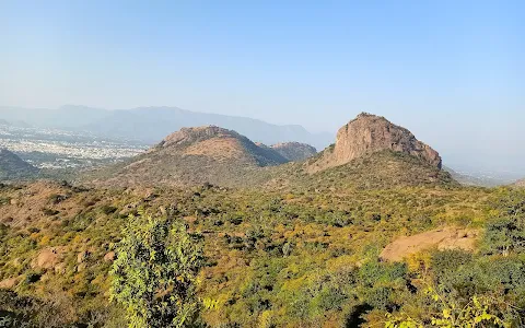
The
hill
fort
located
in
Namakkal
is
the
highlight
of
the
city.
The
fort
is
located
on
a
flat
area
of
one
and
a
half
acres.
The
fort
can
be
reached
by
narrow
steps
located
in
a
southwesterly
direction.
The
Namakkal
area
was
once
ruled
by
Gunaseela,
an
Attikula
king
who
was
married
to
a
Pallava
dynasty.
Later
under
the
rule
of
the
Cholas
who
invaded
the
Kongu
region
in
the
9th
century,
and
later
under
the
rule
of
the
Vijayanagara
Empire,
Mathura
came
under
the
Governor's
office.
After
that,
it
was
dominated
by
one
of
Haider
Ali's
generals
and
captured
by
the
British
in
1768.
The
northern
parts
of
Namakkal
district
are
hilly
and
the
southern
parts
are
plains.
The
main
waterfalls
of
the
district
are
Kaviriyaru,
Aiyaru,
Karippottan
and
Thirumanimuttaru.
Of
these,
the
Cauvery
River
flows
in
a
south-southwesterly
direction,
bordering
the
district.
Kollimalai
is
the
garden
of
Namakkal
district.
It
is
administered
by
a
Panchayat
Union
comprising
of
16
Grama
Panchayats
known
as
‘Nadu’.
Kollimalai
covers
an
area
of
371.03
sq.
Km.
In
area,
it
is
located
at
an
altitude
of
1300
meters
above
sea
level.
The
tribes
here
are
‘Malayalees’.
The
area
was
ruled
by
a
short-lived
king
named
Valvil
Ori,
one
of
the
Seven
Valleys.
The
famous
Arabiliswarar
Temple
here
was
the
abode
of
Jain
monks
before
the
domination
of
Hinduism.
There
is
a
famous
waterfall
called
'Akaya
Ganga'
near
the
temple.
Namakkal
has
a
prominent
place
on
the
map
of
India
due
to
its
trucking
industry.
The
industry
is
unique
in
naming.
Namakkal
has
been
operating
nesting
workshops
for
more
than
150
lorries
and
other
related
industries
since
the
1960s.
There
are
many
types
of
lorries
in
Namakkal
district
such
as
lorries,
tow
trucks
and
tanker
lorries
carrying
cooking
gas.
It
is
also
known
as
the
‘City
of
Transportation’
due
to
this.
The
famous
Namakkal
poet
Ramalingam
Pillai
was
born
in
Namakkal.
A
College
of
Arts
and
Science
for
Women
has
been
established
in
her
name
in
her
name
in
Namakkal.
One
of
the
famous
Veterinary
Colleges,
Veterinary
College
and
Research
Station
is
located
in
Namakkal
district.
In
addition,
a
large
number
of
private
educational
and
technical
institutions
are
being
established.
The
shrine
of
the
famous
Namakkal
Anjaneyar
Swami
is
6.7
meters
high.
It
was
carved
in
996
AD.
Also,
the
Narasimhar
Swamy
and
Amman
temples
are
located
on
the
western
side
of
the
hill
fort
in
the
heart
of
Namakkal
city.
(Original)
மலையின்
மீது
அமைந்துள்ள
பாலடைந்த
கோவிலின்
வடமேற்கு
மற்றும்
தெற்கு
சுவறுகளில்
அமைந்துள்ள
கல்வெட்டுகளில்
நாமக்கல்
பகுதி
‘திருவரைக்கல்’
என்று
குறிப்பிடப்பட்டுள்ளது.
நாட்டின்
பெறும்பாலான
பகுதிகளுக்கு
அனுப்பப்படும்
முட்டைகள்
நாமக்கல்
பகுதியில்
உற்பத்தி
செய்யப்படுவதாலும்,
நாமக்கல்
‘
கோழிகள்
நகரம்’
என்றும்,
‘முட்டை
நகரம்’
என்றும்
அழைக்கப்படுகிறது.

நாமக்கல்
நகரில்
அமைந்துள்ள
மலைக்கோட்டையானது
இந்நகரத்தின்
சிறப்பம்சமாகும்.
இக்கோட்டையானது
சமதளமான
பகுதியில்
ஒன்றரை
ஏக்கர்
பரப்பளவில்
அமைந்துள்ளது.
தென்மேற்கு
திசையில்
அமைந்துள்ள
குறுகலான
படிகளின்
மூலம்
இக்கோட்டையை
சென்றடைய
முடியும்.
ஒருகாலத்தில்
நாமக்கல்
பகுதியானது
பல்லவ
வம்சத்தில்
மணம்புரிந்திருந்த
அட்டிக்குல
மன்னன்
குணசீலா
என்பவரின்
ஆட்சியில்
இருந்துள்ளது.
பின்னர்
9ம்
நூற்றாண்டில்
கொங்கு
மண்டலத்தின்
மீது
படையெடுத்து
வென்ற
சோழர்களின்
ஆட்சியின்
கீழ்
இருந்து,
பின்னர்
விஜயநகர
பேரரசின்
ஆளுகையின்
கீழமைந்த
மதுரா
பதில்
ஆளுநர்
அலுவலின்கீழ்
இருந்து
வந்துள்ளது.
அதன்
பின்னர்,
ஹைதர்
அலியின்
படைத்தலைவர்களில்
ஒருவரால்
ஆதிக்கம்
செலுத்தப்பட்டு,
1768
ம்
ஆண்டு
ஆங்கிலேயர்களால்
கைப்பற்றப்பட்டது.
நாமக்கல்
மாவட்டத்தின்
வடக்கு
பகுதிகள்
மலைப்பிரதேசமானவும்,
தெற்கு
பகுதிகள்
சமவெளிகளாகவும்
காணப்படுகின்றன.
இம்மாவட்டத்தின்
பிரதான
அருவிகளாக
காவிரியாறு,
ஐய்யாறு,
கரிப்பொட்டான்
ஆறு
மற்றும்
திருமணிமுத்தாறு
ஆகியவை
திகழ்கின்றன.
இவற்றில்
காவிரி
ஆறானது
தெற்கு-
தென்மேற்கு
திசைகளில்,
மாவட்டத்தின்
எல்லையை
அறவனைத்தவாறு
செல்கிறது.
நாமக்கல்
மாவட்டத்தின்
தோட்டம்
எனப்படுவது
கொல்லிமலை
.
இது
‘நாடு’
என்று
அழைக்கப்படும்
16
கிராம
பஞ்சாயத்துகளை
உள்ளடக்கியுள்ள
ஊராட்சி
ஒன்றியத்தின்
முலம்
நிர்வகிக்கப்படுகிறது.
கொல்லிமலை
371.03
சதுர
க.மீ.
பரப்பளவில்,
கடல்
மட்டத்திலிருந்து
1300
மீட்டர்
உயரத்தில்
அமைந்துள்ளது.
இங்குள்ள
பழங்குடியினர்
‘மலையாளிகள்’
ஆவர்.
இப்பகுதி
கடையேழு
வல்லல்களில்
ஒருவரான
வல்வில்
ஓரி
எனும்
குறுநில
மன்னரால்
ஆட்சி
செய்யப்பட்டுள்ளது.
இங்குள்ள
பிரசித்தி
பெற்ற
அரப்பலீசுவரர்
கோவில்
இந்து
மதத்தின்
ஆதிக்கத்தின்
முன்பு
ஜெய்ன
மத
துறவிகளின்
உறைவிடமாகத்
திகழ்ந்துள்ளது.
இக்கோவிலின்
அருகில்
‘ஆகாய
கங்கை’
என்னும்
பிரபலமான
அருவி
அமைந்துள்ளது.
லாரிகளுக்கு
கூடு
கட்டும்
தொழிலின்
காரணமாக
நாமக்கல்
இந்திய
வரைபடத்தில்
முக்கயமான
இடத்தைப்
பிடித்துள்ளது.
இத்தொழில்
நாமக்கல்லின்
தனிச்சிறப்பு.
1960களில்
இருந்து
சுமார்
150க்கும்
மேற்பட்ட
லாரிகளுக்கு
கூடு
கட்டும்
பட்டறைகள்
மற்றும்
அவற்றினை
சார்ந்த
பிறவகை
தொழில்களும்
நாமக்கல்லில்
செயல்பட்டு
வருகின்றன.
லாரிகள்,
இழுவை
இணைப்பு
வண்டிகள்
மற்றும்
சமயல்
எரிவாயு
கொண்டு
செல்லும்
டேங்கர்
வகை
லாரிகள்
போன்ற
பலவகை
லாரிகள்
நாமக்கல்
மாவட்டத்தில்
உள்ளன.
இதன்
காரணமாக
‘
போக்குவரத்து
நகரம்’
என்றும்
அழைக்கப்படுகிறது.
புகழ்பெற்ற
நாமக்கல்
கவிஞர்
ராமலிங்கம்
பிள்ளை
நாமக்கல்
நகரத்தில்
பிறந்தவராவார்.
இவரது
நினைவாக
நாமக்கல்
நகரத்தில்
இவரது
பெயரில்
மகளிருக்கான
கலை
மற்றும்
அறிவியல்
கல்லூரி
நிறுவப்பட்டுள்ளது.
புகழ்பெற்ற
கால்நடைக்
கல்லூரிகளில்
ஒன்றான
கால்நடை
மருத்துவக்
கல்லூரி
மற்றும்
ஆராய்ச்சி
நிலையமானது
நாமக்கல்
மாவட்டத்தில்
அமைந்துள்ளது.
மேலும்,
தனியார்
கல்வி
மற்றும்
தொழில்நுட்ப
நிறுவனங்களும்
அதிக
அளவில்
நிறுவப்பட்டு
வருகின்றன.
பிரசித்தி
பெற்ற
நாமக்கல்
ஆஞ்சநேயர்
சுவாமயின்
சலையானது
6.7
மீட்டர்
உயரம்
கொண்டது.
அது
996
கி.பி.-ல்
செதுக்கப்பட்டதாகும்.
மேலும்,
நரசிம்மர்
சுவாமி
மற்றும்
அம்மன்
கோவில்கள்
நாமக்கல்
நகரத்தின்
மையப்பகுதியில்
உள்ள
மலைக்கோட்டையின்
மேற்கு
பகுதியில்
அமைந்துள்ளன.
1 person found this review helpful 👍