4/5 CHU KOK W. 5 years ago on Google
One
of
the
most
convenience
hill
location
in
Klang
Valley
for
KL
people.
Located
along
the
16km
Klang
Gates
Quart
Ridge,
the
hill
offers
a
magnificent
and
eye
opening
view
when
you
reached
the
top
at
about
865
ft
above
sea
level.
Access
via
Zoo
Negara
heading
towards
Kg
Kemensah
and
park
around
ATV
Adventure
Park
at
RM3
per
entry.
New
driver
must
be
extra
careful
when
driving
along
the
narrow
tar
road
leading
to
the
parking.
The
walk/hike
to
the
top
would
take
around
30
-
45
minutes
depending
on
your
fitness.
Mosquitoes
repellent
should
be
applied
if
you
are
allergy
to
this
small
creatures.
There
is
3
stops
on
the
hill
top
with
the
3rd
and
last
peak
offering
KL
city
view
while
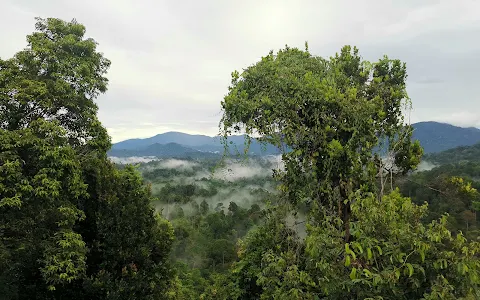
the
2nd
stop
where
the
landmark
is
situated
offering
a
refreshing
greenery
of
Banjaran
Titiwangsa.
Extra
care
and
safety
is
very
important
when
going
up
to
tje
top
and
on
the
top
as
the
rocks
are
all
ends
with
cliff
with
no
safety
net.
Children
below
12
should
stop
at
1st
peak
as
it
is
quite
challenging
and
dangerous
for
them
to
reach
and
stay
on
the
2nd
and
3rd
peak.
Overall
a
good
hill
for
city
folks.
Will
definitely
come
back
again.