4/5 Flori a. 4 years ago on Google • 308 reviews
The
Mühlenberger
Loch
The
tides,
storm
surges
and
drifting
ice
have
created
a
richly
structured
mosaic
of
habitats
in
the
Mühlenberger
Loch.
This
provides
habitat
and
food
for
a
variety
of
rare
and
endangered
animal
and
plant
species.
In
addition,
the
Mühlenberger
Loch
is
also
characterized
by
biogenic
oxygen
production,
which
means
that
the
area
serves
as
a
refuge
for
numerous
aquatic
inhabitants
during
summer
oxygen
holes
in
the
Stromelbe.
The
freshwater
mudflats
of
the
Mühlenberger
Loch
now
represent
some
of
the
largest
such
mudflats
in
Germany.
The
EU
bird
sanctuary
Mühlenberger
Loch
has
internationally
important
resting
areas
for
the
migratory
bird
species
shoveler,
teal
and
little
gull,
common
gull,
shelduck
and
black-headed
gull.
In
nationally
important
populations,
the
area
is
used
by
black
terns
and
pintail
ducks
during
migration.
Overall,
the
Mühlenberger
Loch
is
one
of
the
most
important
areas
for
bird
migration
on
the
Lower
Elbe.
The
high
food
supply,
the
good
oxygen
supply
and
the
calm
location
are
the
reasons
for
the
abundance
of
fish
in
the
Mühlenberger
Loch,
with
the
importance
of
this
area
with
its
combination
of
mudflats
flooded
during
tidal
floods
as
well
as
shallow
and
deep
water
areas,
primarily
in
the
rearing
of
young
fish.
Overall,
the
fish
densities
in
the
Mühlenberger
Loch
are
at
times
more
than
a
hundred
times
greater
than
in
other
areas
of
Hamburg's
Lower
Elbe.
Hemlock
water
fennel
thrives
in
the
area's
reedbeds
and
riparian
forests.
The
tidal
flats
of
the
FFH
area
also
represent
an
important
genetic
reservoir
for
this
Elbe
demite
in
their
function
as
a
seed
bank,
as
they
can
survive
there
for
decades.
Due
to
the
fact
that
¾
of
all
individuals
living
worldwide
only
in
the
area
of
the
freshwater
tidal
Elbe
occur
in
Hamburg,
Hamburg
has
a
special
responsibility
for
the
global
conservation
of
the
species.
The
island
of
Neßsand
The
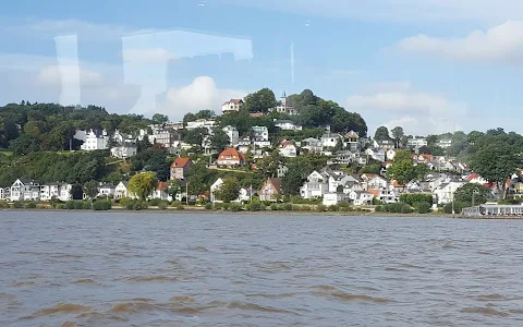
view
of
the
nature
reserve
is
from
the
Geest
slope
of
the
Elbe
between
Blankenese
and
Wittenbergen,
the
most
impressive
view
of
the
area
is
from
the
Bismarkstein.
The
island
lies
elongated
in
the
river,
washed
by
its
main
fairway
and
the
Hahnöfer-Nebenelbe
branch
of
the
Elbe.
It
forms
the
western
end
of
the
large
shallow
water
basin
"Mühlenberger
Loch",
has
two
further
parts
with
Pig
Sand
in
the
east
and
Hans-Kalb-Sand
in
the
west
and
is
home
to
three
federal
states.
Hamburg
Schleswig-Holstein
and
Lower
Saxony
share
sovereignty
along
the
border.
The
nature
reserve
is
managed
and
looked
after
by
Hamburg.
A
nature
conservation
warden
lives
temporarily
on
the
island.
There
is
no
public
boat
or
ferry
service
to
Neßsand.
Entering
the
nature
reserve
is
prohibited.
Boats
are
allowed
to
land
at
designated
landing
points
and
the
island
may
be
accessed
in
the
sandy
beach
area.
Plant
world
The
island's
appearance
is
characterized
by
three
types
of
vegetation:
the
dry
grassland,
the
alluvial
forest
and
the
broad
reed
belts
in
the
mudflats
on
the
southern
bank.
Due
to
the
strong
tidal
flow
of
the
main
Elbe
fairway,
a
hard
sand
flat
has
formed
on
the
north
bank.
A
long,
steep
sandy
beach
leads
from
there
to
a
dry
grassland
area
lined
with
willow
bushes.
Here,
where
the
nutrient-poor
sand
is
no
longer
reached
by
the
tide,
which
otherwise
supplies
it
with
sediment
as
fertilizer,
the
frugal
sand
sedges,
silver
grass
and
sand
grass
grow.
The
hot
stonecrop
stores
enough
water
in
its
fleshy
leaves
to
survive
dry
periods.
On
the
south
bank
the
tide
appears
calmer
and,
depending
on
the
height
and
duration
of
the
flood,
shapes
the
plant
communities.
In
the
muddy,
quiet
bays,
the
corn
reeds
form
the
uninterrupted
lower
edge
of
the
bank.
The solidifying
sand
and
silt
prepare
the
ground
for
the
tall-growing
reeds
such
as
broad-leaved
and
narrow-leaved
cattails.
At
higher
altitudes
on
better
ventilated
soil,
dense
reed
vegetation
thrives:
thatch.
Particularly
beautiful
in
spring