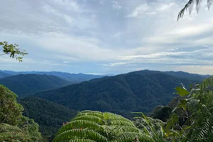
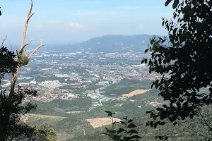
Bukit Kepayang Hiking Trail
Hiking area👍👍 An everyday hiking place. Best place to practice and improve your cardio and stamina. People often mention hill, trail, view, Kepayang,
Address
Jln Tmn Bkt Kepayang Besar 1, Taman Bukit Kepayang, 70200 Seremban, Negeri Sembilan, Malaysia
Rating on Google Maps
4.50 (311 reviews)Open on Google Maps
Working Hours
- Friday: Open 24 hours
- Saturday: (Lunar New Year), Open 24 hours, Hours might differ
- Sunday: (Lunar New Year), Open 24 hours, Hours might differ
- Monday: (Lunar New Year (Observed)), Open 24 hours, Hours might differ
- Tuesday: Open 24 hours
- Wednesday: Open 24 hours
- Thursday: Open 24 hours