4/5 Shahjalal S. 9 months ago on Google
Chandranath
hill
trekking,
Sitakunda
Chandranath
hill
is
one
of
the
great
places
for
those
trekkers
who
likes
trekking.
This
hills
located
in
Sitakunda
which
is
a
land
of
outstanding
natural
beauty.
From
Sitakunda
it
is
around
4.5km
far.
Chandranath
has
the
small
hill
groups.
On
the
way
to
the
hill,
tourist
will
see
some
religious
places
of
Hindu
religion.
This
hill
area
has
various
kinds
of
trees.
Here
tourist
can
see
the
gardens
of
fruits
like
Guava,
Mango
and
Coconut
etc.
It
is
easy
from
other
trekking
to
climbing
up
and
down
on
the
hilly
way
by
the
stairs.
In
this
area
has
some
people
called
Tipra
and
they
have
a
village.
The
hills
look
very
marvelous
at
rainy
season,
because
of
rainfall
to
the
trees
and
hills
looks
very
awesome.
But
as
well,
itis
very
dangerous
to
climb
this
hill.
How
to
Reach:
By
Bus:
There
are
many
AC
and
NON-AC
buses
from
Capital
Dhaka
or
around
Bangladesh
like
Green
line,
Shohag,
Hanif,
Shyamoli,
Desh
travels,
Unique,
Soudia,
and
S.Alam.
AC
buses
fare
is
around
1000
BDT
and
non-ac
fare
are
500
BDT.
To
get
the
bus
tickets
tourist
needs
to
buy
from
the
Bus
Counter
in
Gabtoli,
Kalyanpur,
Saydabad
and
Arambag.
From
Dhaka
it
takes
almost
6
hours
to
reach.
By
Train:
If
any
tourist
wants
to
go
by
train
they
will
get
train
tickets
from
Kamalapur
railway
station.
It
will
take
10
hours
to
reach.
Train
fare
is
300-1000
BDT.
By
Air:
Tourist
also
can
go
by
air.
They
need
to
book
tickets
from
online
by
airways
company
website
or
any
travel
agent
or
from
Dhaka
airport
domestic
terminal.
There
are
few
airways
like
Bangladesh
Biman,
US
Bangla,
Regent
Airways
and
Novo
air
from
Dhaka
airport
to
CTG
airport.
One
way
fare
is
around
2700
BDT
in
the
economy
and
the
round
fare
is
5400
BDT,
for
business
class,
it
is
a
little
bit
higher.
Tour
Itinerary
It
is
best
to
start
the
journey
at
10.30pm.
If
any
tourist
start
from
Dhaka
by
bus.
After
reaching
Sitakunda
at
6:00
am.
Getting
fresh
in
the
restaurant
and
take
the
breakfast.
Then
we
proceeded
towards
Chandranath
hill.
Use
the
Google
Map
if
anyone
gettrouble
to
knowing
the
way
for
the
hill
without
asking.
The
height
of
Chandranath
temple
hill
is
approximately
1530
feet.
It
needsto
take
a
CNG
to
reach
the
basement
of
Chandranath
hill
From
the
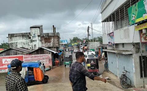
SitakundaBazar.
Fare
is
20
BDT
per
head.
Then
the
trekking
started
for
top
of
the
hill.
There
are
two
ways
to
reach
the
top
of
Chandranath
hill.
One
is
by
staircase
and
another
is
regular
trekking
road.
Tourist
can
see
some
nice
beautiful
temples
on
the
way.
It
will
take
around
2
hours
to
reach
the
top
of
the
hill.
But
the
tiredness
will
go
away
when
a
tourist
will
see
the
outstanding
view
of
the
surrounding
place
from
top.
So
much
mesmerizing,
fabulous.
Spend
amazing
time
there
and
watching
the
stunning
views
of
around
Chandranath
hills.
Now
it’s
time
to
move
back
to
the
basement.
It
may
take
around
45
minutes
to
get
down.